Hiking the Lerderderg Gorge Circuit
When I left home on a slightly chilly Saturday morning, my only plan was “go for a walk somewhere” and I knew in the absence of any sudden…

When I left home on a slightly chilly Saturday morning, my only plan was “go for a walk somewhere” and I knew in the absence of any sudden inspiration, I was going to head in a Lerderderg-ish direction, mainly because in my head I love saying “Lerderderg” as if I’m the Swedish Chef. I did not think I was about to take on a fairly serious bit of trail in poor weather with a lack of preparation. I did anyway.
The only definite thing I had in mind when I hit the road was that I was going to scope out the MacKenzies Flat Picnic Area for reasons. At some point I want to do some overnight walks in the Lerderderg and I always figured that’d be where I parked the car before heading out. It just looked pretty convenient compared to some of the other options, but maybe I’d go “oh hell no” for some reason when I saw it. Well, today was going to be the day I just pulled into the car park and got some answers.
The picnic area itself wasn’t inspiring at all, but why would it be? I did note the night before that someone had reviewed the toilets there as exceptionally fragrant. I’ve used a lot of long drop toilets around the country and none of them are something I’d want to put in a bottle and dab behind my ears before a date. It’s just part of the deal.
Reader, I don’t know what’s down there, but those are the foulest toilets I have ever smelled, and this was the middle of winter. I dread to think what they’d be like in the height of summer. They need to install a Chernobyl #4 style containment shed, and a warning plaque at least. Let us never speak of them again.
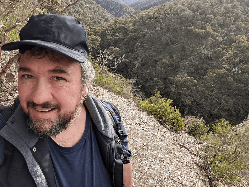
After about 10 minutes of wandering about to get my bearings, I grabbed my day bag which pretty much just had a couple of bread rolls, a waterproof jacket and about 3 litres of water in it. I left my hiking poles in the car, along with the extra powerbank for my phone. I was going to just scoot down the main trail a bit and come back and I saw families with small children coming back from down there. I pulled up the Parks Victoria large scale map PDF to make sure I had something at least if I wandered out of reception range, and set off. I didn’t pay much attention to the info boards around the picnic ground, assuming it would just be duplicates of the PDFs I already had.
MacKenzies Flat to Grahams Dam
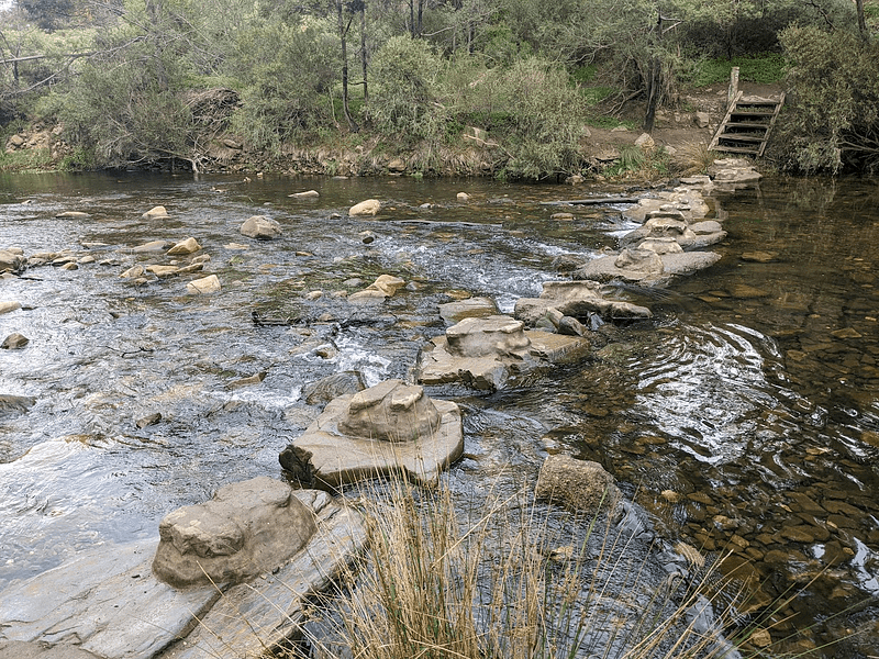
The trail initially is very flat and level. There’s a stepping-stone river crossing that’s quite stable and actually pretty fun. I would have loved the shit out of this when I was a kid. If my mum had brought me here when I was five I’d have been dreaming about it for decades to come. The trail beyond that is flat still, with a lot of little branches off to flat sections of river bank where people can get easy access to the calm, flat water. Are you picking up the theme here? It’s flat.
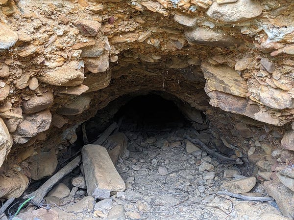
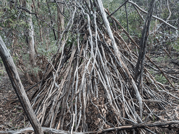
Not feeling any time pressure, I scooted up the bank in a couple of spots where it looked like some people might have done so in the past. I imagined old gold mines with boards roughly nailed across the front, wells with buckets on ropes, rusty old shovels, restless ghosts of old prospectors … you know the drill. Of course, in a spot that’s no more than a 15 minute casual stroll from a car park, the reality was significantly less interesting. I did find a spooky hole that might be a filled-in mining excavation and a weird structure made of stacked sticks that I backed away slowly from, lest I annoy a local witch.
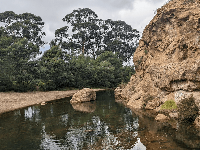
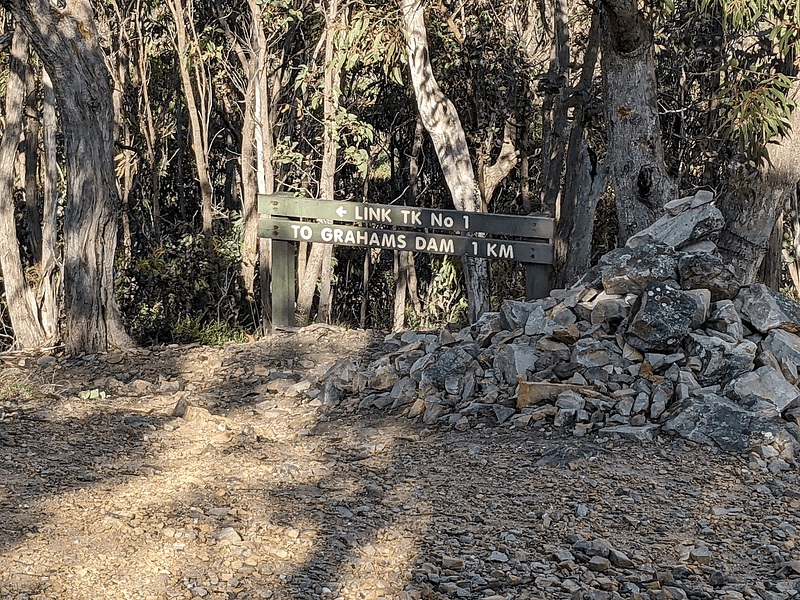
Anyway, a bit of a stroll later and I was at Grahams Dam! I don’t know what I was expecting — unusually for me I didn’t seek out a lot of pictures of where I was headed, as I didn’t really have a plan going in. I expected a bit more than what I got, but at least it was getting interesting right? I had waterproof boots on, even if I didn’t have a pole to stabilise me or anything. This was nothing. Let’s go over the other side.
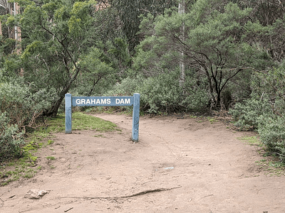
Calling something a “dam” sounds like quite a big deal, but the stakes were not very high here, let’s be honest.
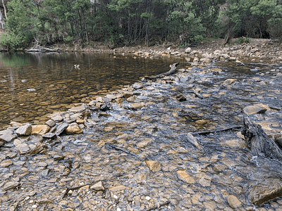
So here I was at Grahams Dam, which apparently is a nice place for a swim in summer. Unfortunately, here I was in the middle of winter and I’d come out here thinking it’d be a good place to have lunch, but there wasn’t even a giant rock or conveniently-oriented log to sit on. I looked at where the trail headed off up river to the north, another river crossing like the last one but not quite so well defined and requiring a couple of definite steps into the actual water onto submerged rocks.
“Nah,” I thought to myself, “I’ll never get over that without getting my socks wet.”
insert dramatic foreshadowing music here
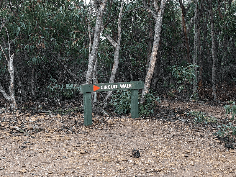
Instead there was another trail heading off up a hill, simply marked “circuit walk”. That sounded OK, and it was going uphill, so I figured there’d be a nice lookout somewhere where I could sit and eat my rolls. And look, I wasn’t wrong about that in the end.
Link Number 1 Track
The signage and maps implied the distance to the turnoff to the next trail was only about 1km from Grahams Dam, so I thought it’d be a good idea to get to there and decide about just retracing my steps or doing the full circuit. It started out a bit steep but I was feeling pretty fresh. A bloke and two noisy kids rocked up to the dam as I started, so that gave me a bit of motivation to get cracking. I started going up.
The sound of the bloke and the children faded away and the sun came out. I started shedding layers until I was just down to a t-shirt. I got some phone reception back at this point, checked back in to see if the world needed me (it didn’t, quelle surprise) and downloaded some topographic maps just in case. I should have looked at them as well.
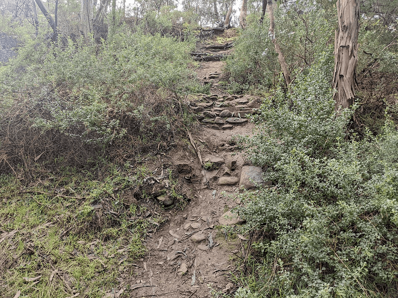
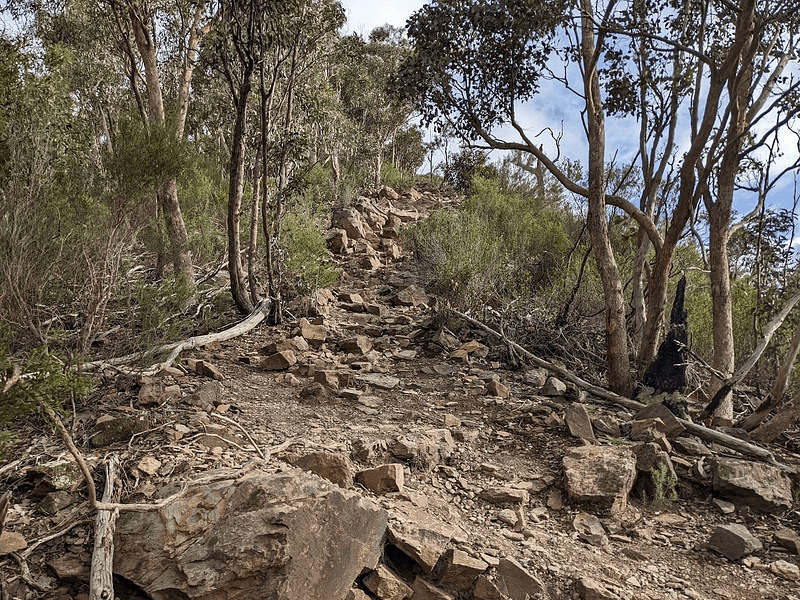
Remember how the recurring theme earlier had been flat? Well we were into a new world now, where the word of the day was up, and not in the fun “my wife died so I tied balloons to my house and stole a child” kind of way. Usually on a climb I kind of expect a few twists and turns and occasional flat stretches. No. This just goes up. That’s what it does. That’s all it does.
The climb isn’t exactly extreme, but it’s very consistent.
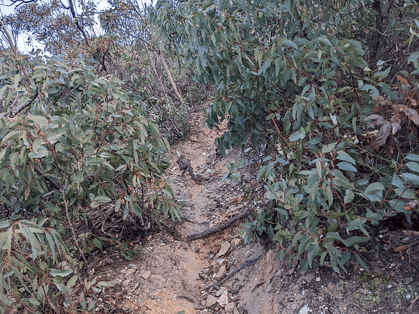
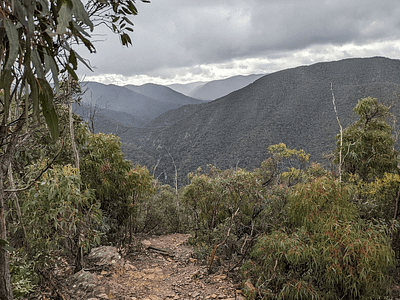
Sometimes it goes up through slippery loose rocks, sometimes through slender trees, and sometimes it goes up through low scrubby bushes. Sometimes it goes up and you can see whats behind you though … and well, those bits kind of keep you going.
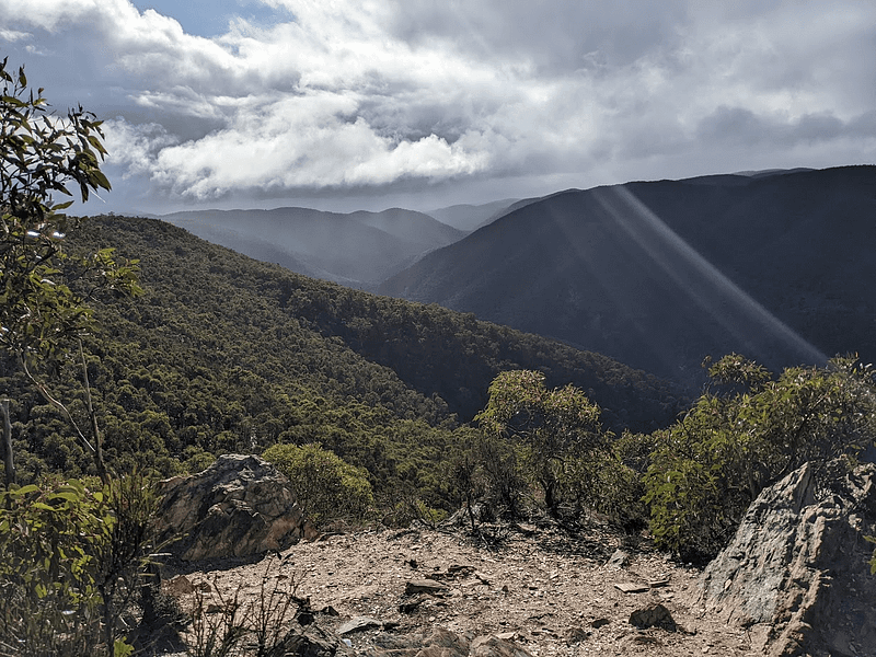
Eventually, just as I was about convinced that this just kept going up forever, thinking that maybe I’d actually died somewhere back there on the trail, and this was my eternity now as a restless spirit condemned to trudging upwards, the leitmotif for flat suddenly made a reappearance in the day’s soundtrack and the ground changed, the sun peeked out from behind a cloud and … wow.
I sat down for a good 15 minutes or so, drank a lot of water and thought about what to do next. I figured I’d go up to the junction ahead where the Great Dividing Trail ran through and was briefly a part of the circuit walk. My long-term dreams include doing some of the big multi-day trails around Australia so I was curious to take a real look at a section of one of them, even for just a moment.
At the trial junction there’s a pile of rocks. I’m not big on the idea of rock stacking in the wilderness but this was by a large vehicle track and the attitude conveyed by this pile was more “yeah fuck you, hill” than suggesting that some Zen-like meditative bliss had guided the placement of the stones. I tossed one on the pile, muttered “fuck you, hill” and walked on.
Blackwood Ranges Track
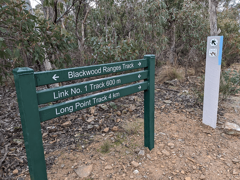
I’m now on the Blackwood Ranges Track apparently, and that’s a name I recognised from reading about a lot of potential walks up here. I’m sure I’ll see it again. Long Point Track is one I think I’ll see in the near future too, but that’ll be a day when I plan things a bit more. I’m certainly not going to add another 4km spontaneously on a day where I’ve already improvised myself into a lot more work than I expected. I was coming up now on the counterpart to the majestically named “Link No 1 Track” — the good old “Link No 2 Track”.
Link Number 2 Track
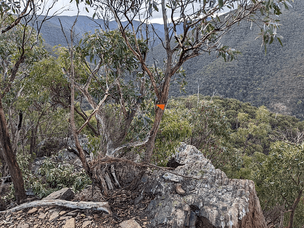
Now I’m finally seeing some reassuring orange triangles. I guess they weren’t needed much on the last leg, as the trail was never ambiguous, and your choices were mainly limited to “up”, “down” and “down very, very fast”. It was starting to drizzle a bit now but I decided to commit to the full circuit instead of backtracking. I didn’t like the idea of trying to get back down the steep No 1 Track with a light rain making the loose rock slippery on top of everything else.
insert dramatic foreshadowing music here
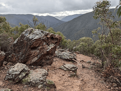
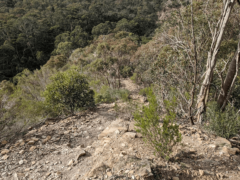
Link No 2 Track starts brilliantly from the top, great views and more interesting features than No 1.
Things started really well on this track, convincing me this was going to be a quick trip home. I snapped a lot of pictures, and sent some optimistic messages to some people as I was in a brief patch of mobile reception again. Look, I know I am being a bit sarcastic in this post, but this really is some spectacular countryside and it’s a great place to spend some time. Just … come prepared and do your research beforehand, OK?
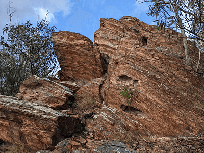
The first “oh shit” moment came when I looked down ahead of me at something I’d be more inclined to call a cliff than a trail. Fortunately it looked intimidating enough that I took a good look around and saw a trail marker pointing away from it, to a better looking path that meandered around to the left a bit. This, I think, is my biggest gripe with this trail. You need to watch your footing all the time. This makes it a bit challenging to take in the scenery, the wildlife and the blessed orange triangles. It was clear I needed to slow down, despite how much I wanted to get out of here.
This is probably as good a moment as any to mention that I’ve since learned I was doing this walk in the opposite to the recommended direction. I thought it was pretty clear that descending No 1 Track would be a bit hairy. Turns out that one’s actually the better option. Yeah, keep that in mind for the rest of the descent story, OK?
Before jumping off any cliffs, just pause a moment and look for other options.
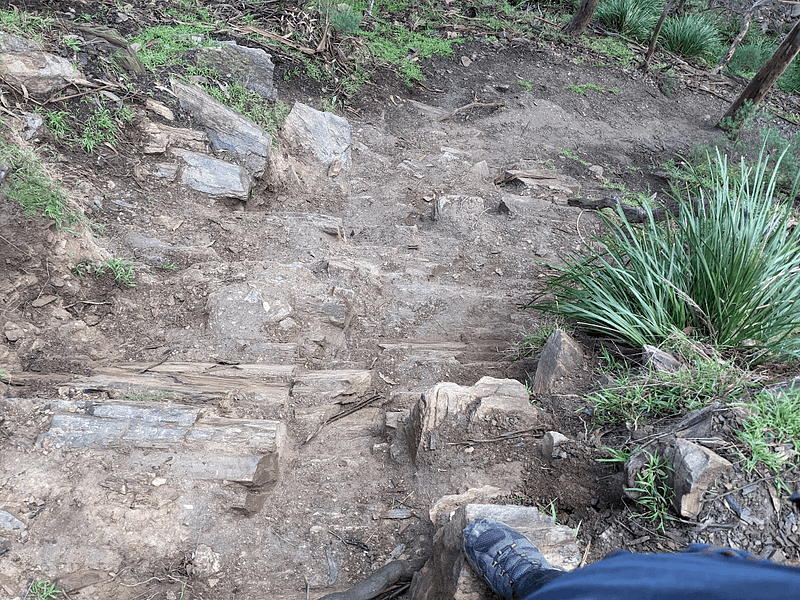
That I was doing this in the wrong direction became more and more apparent the further down I want. I started deliberately sliding on my arse for stretches as I couldn’t see any way I wouldn’t slip on the now-slightly-muddy ground. I thought a lot about my trekking poles that were sitting in the back of the car, and cursed Past Mike for being a bit cocky and Present Mike for not doubling back.
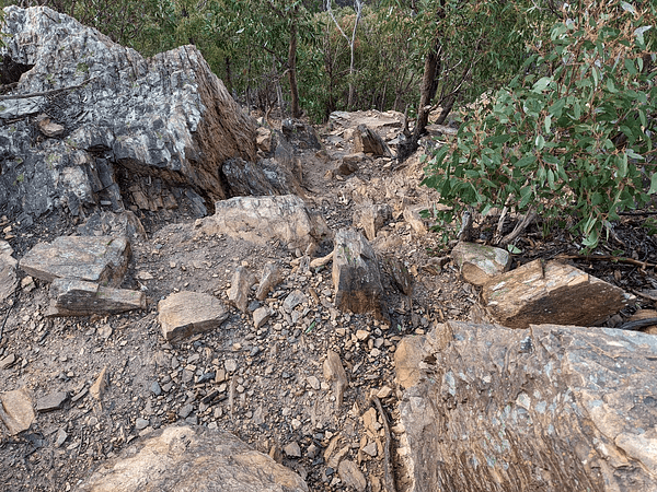
I finally could actually hear the river below me, but the track wanted to take one last shot at me for going the wrong way. Another section that looked more like a cliff, but no secret orange triangles were coming to my rescue this time, apparently. I attempted to climb down, sitting on rocks, hands and feet all in contact with the ground — but I slipped and bashed my arse heavily on a rock anyway. Probably got a substantial bruise back there now, but I can’t bend that way so it’ll have to remain a mystery.
Don’t Trust the Maps! Here’s a fun fact that I’ve since seen confirmed by several other accounts of this trail. The official maps of the trails in the park do not show the location of Link No 2 Track correctly. It used to end further upriver, but no longer! If you’re tracking yourself with GPS against published maps, you have NOT gone the wrong way here. The signage at the bottom confirms that No 2 Track’s end is not where the maps show it.
Link Number 2 to Grahams Dam
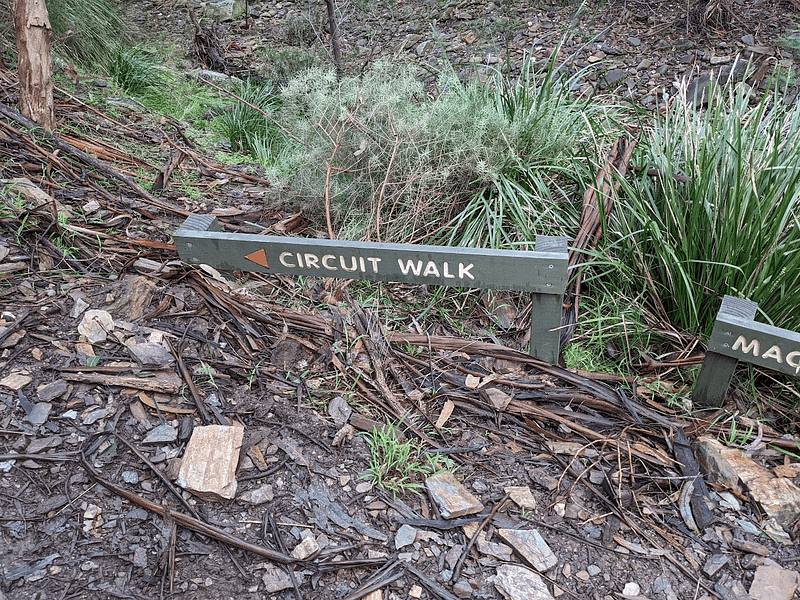
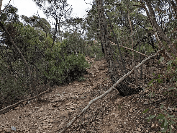
Getting to the bottom, finally at river level, there’s old mate “circuit track” board showing that we haven’t messed things up too much! It even pointed off towards MacKenzies Flat, just to get you into what turns out to be a false sense of security. I pretty much bounced off down the riverbank, thinking I was pretty much done.
That feeling didn’t last long, as the trail turned into … well … some damp rocks.
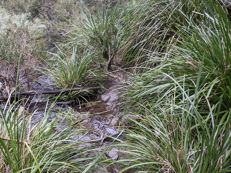
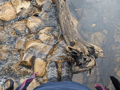
I almost certainly had missed a triangle somewhere, and that was a river crossing point. I was in a section now where the river was a bit deeper, no surface rocks, and no clear path ahead. I was either going to go back or go into the river, wasn’t I? I mostly stopped taking photos at this point as I just wanted to get out of the park, get back to the car, and eat one of the bananas I knew was in a bag there.
I pushed through the weeds a little bit more, and found a kind of OK point to cross at least, without having to go backwards. My jeans wicked up a lot of water in the process though, and I knew this was the moment I was committed to walking home in wet socks. On the other side though, I pretty rapidly saw something that was clearly a well-used trail and I could pick up the pace.
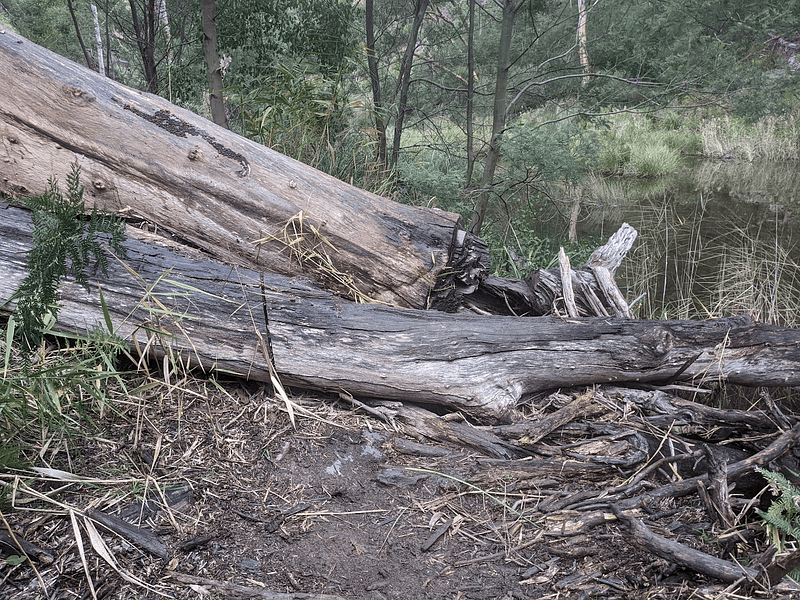
At least getting lost was never on the cards. It’s hard to do that when you’ve got a bloody great river to follow. There was a bloody great tree over the path at one point, but that was nothing compared to the day so far. I barely slowed down and just jumped clear over it in a single bound (this is a lie)!
Denouement
The trail took me pretty rapidly back to Graham’s Dam, and then back down to the river crossing I’d decided not to do earlier, because I thought it’d guarantee wet socks, and which caused me to turn around and do the circuit walk in the “wrong” direction. So here I was, at the same place, with wet socks still and a bruised bum. I didn’t even try to rock hop this time, or at the next crossing. I just walked through the bloody river.
I got back to the car, dumped my bag, smashed a banana, braved the epic stink of the toilet, sanitised my hands three times for luck, and had another banana. I was wandering a little in the picnic ground for this and finally went over to the info board I’d skipped earlier.
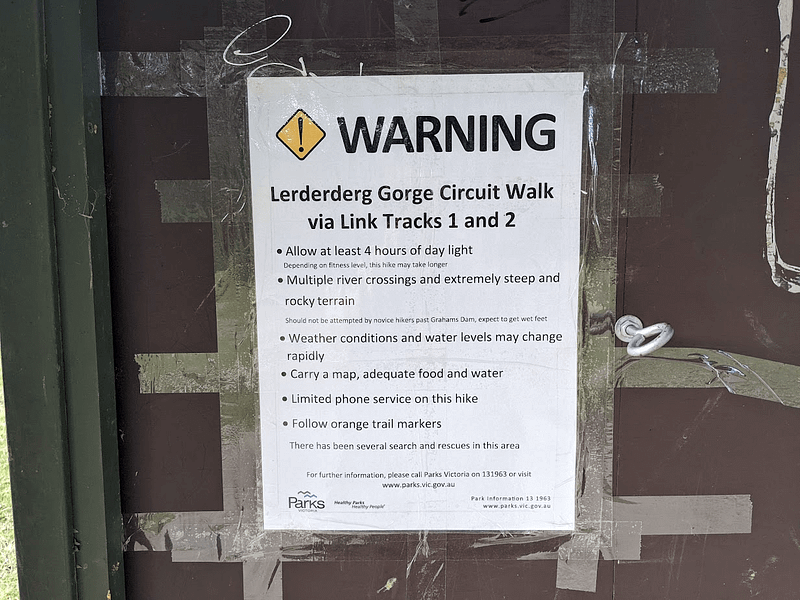
I have to admit, when I saw just the simple words “circuit walk” it really did conjure up feelings of a casual afternoon stroll past some cool features. If I’d seen this first would I have believed it? Would I at least have gone and grabbed the poles and maybe thrown an extra banana in my bag? Would I have looked up more info first and found out the “right” direction to do it in? Would anything at all have been different?
Who knows? I can tell you one thing for sure — if I hadn’t hurt my arse, I wouldn’t have sat on the couch all evening with a laptop typing this today.
Makes you think.